
Wah, Pakistan. 11th May, 2023.
After staying the night with Soihil, and once we’d been to the café for breakfast, I headed back along the GTR before turning north, heading for higher ground.
The mountains in the north of Pakistan are divided into two main ranges. To the east is the Karakorum range. To the west is the Hindu Kush, which includes parts of Afghanistan. There are a number of smaller ranges in-between them. But they are all part of the western arm of the mighty Himalaya. They’re divided by large rivers set in steep valleys, mostly running north/south. This topography accounts for the scarcity of east/west routes. My mission, and I chose to accept it, was to explore as much of this area as I could.
Pakistan’s roads are, for the most part, in pretty good order. It’s clear that much investment has been made, mostly involving the Chinese as far as I could tell. The phrase “Pakistan – China Friendship” was often part of the nomenclature of bridges and tunnels. The other common sight was joint projects for dams and hydro electric plants. I didn’t mind who built the roads, I was just happy to ride them. The engine in my little bike was loosening up nicely now and it handled well.
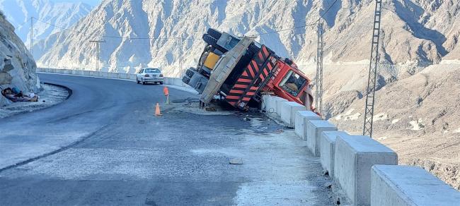
Not everybody seems to appreciate Pak’s good roads. (I hope the driver was OK.)
The first overnight stop was in the town of Besham, a busy but nondescript town. The ride had taken me through small towns and the road had had its rough patches, but it had all been OK. I had a stop for chai and, later, for a cold drink to wash the taste of the road out of my mouth. I could already see snow topped mountains in the distance, beckoning me on. At one of the stops a young guy tried to persuade me to sponsor him for a UK visa application. Silly boy!
The hotel I found asked for 3,000PKR and I talked him down to 2,000. The room had comforts such as a European style toilet and hot water. Lovely. The food in the restaurant was good and included some proper coffee. I was happy. Fortunately it had wi-fi too, which had been missing all day. That was probably related to the disturbances in Rawalpindi. But none of the ATMs worked. Possibly also due to the lack of internet.
The next day had a variety of features. I was now “chasing the Indus” as I rode along side it. The river ran below the road, at the bottom of a steep valley. It was deep, fast flowing and powerful. A monster on the move. I couldn’t help but smile at the irony of how India is named after the Indus River and yet most of it runs through Pakistan, where it also meets the sea.

Strange looking houses next to the river.
As I got higher the hills turned to mountains and the greenery turned to scree laden slopes. A very familiar look to me. I had to stop at a checkpoint where all my details were taken. Then I was invited into the office of the boss police officer, where I felt obliged to drink the disgustingly sweet tea I’d been offered. At every checkpoint thereafter my details were taken, although I didn’t have to drink any more tea, fortunately.
After a chai stop I came to a forced stop at some roadworks. We all had to wait around for a while and I could hear some explosions in the distance. They seemed to be widening the road, and blasting out loose rock too. These mountains were very prone to rockfalls. At the next stop I sat out of the sun, in the road worker’s hut and had a laugh with him about his “Lamborghini” – his scooter with a sticker on it.

Everyone’s entitled to dream.
That night I stayed in Chilas. It sits on the Indus River and is a gateway town into the Gilgit Baltistan area of Pakistan. This region is full of natural beauty, with hidden valleys, lakes and villages among the mountains. The hotel I found was very nice but I was gob smacked at the room price of 8,000PKR. I pretty quickly talked that down to 5,000 but still felt it to be pretty steep. Foreigner price? Well no. I spoke to a couple of local travellers who said they paid the 8,000 but, of course, there were two of them. That put it into a bit more perspective.
Malik had loaned me an SCOM SIM, necessary for these northern areas. The Jazz SIM I’d bought in Lahore wouldn’t work up here. A young lad from the hotel took me to a place where I could get it topped up and, coincidentally, mobile internet also returned after a three day absence. The hotel had a good restaurant, with a nice terrace. Plenty of locals were sitting there and it was noticeable how people now looked very Afghan. Which shouldn’t have been a surprise as I was heading up into the tribal areas. I was very taken by the round, woollen hat the men wore, called a Pakol. It looked as if it would be nice and warm against the mountain winters.
It was very noticeable how many groups of men there tended to be, sitting around in the streets or at cafés, just gossiping. No women to be seen until later in the day when the markets would open. I’d already realised, both in India and here, that male friendship is quite different to the west. It seems to be much closer and it was very common to see men of all ages walking along the street holding hands. Given that homosexuality is frowned on in India, and illegal in Pakistan, this was clearly not sexual, just part of the culture of South Asia. But it still looked odd to my western eye, even though I understood it.

A spectacular road to ride along.
The road was continuing to be in good condition, and pleasant to ride, apart from an occasional rough section. A steep rock face on one side, the busy river down below on the other, made for pleasant riding. The only thing spoiling that was the wind. It had picked up a lot and was strong enough to blow me and my little bike across the road now and then. It was cloudy and looked like rain which, I’m pleased to say, didn’t arrive.
Gilgit is the main city of the GB area. I hadn’t ridden far that day but also I hadn’t left until 11 a.m. The main thing I wanted was a working ATM. North of here facilities might become a bit sparse. In Lahore I’d made good use of Alfalah Bank and a search on Google located one for me. It was in a small square, set back from the road. Now cash rich, I spotted a coffee café in the same square and treated myself to the luxury of a mug of proper coffee and a chocolate brownie. Life on the road can be tough! In the same square I saw a restaurant, above which was a hotel. It had a good room at a good rate so I was a happy bunny.
Until, that was, I realised that I’d left the power lead for my laptop at the hotel in Chilas. The first thing to do was to ring the hotel and ask them to keep it safe for me. The second was to search Google for a computer shop. There was one in another square, just across the road, and they had a secondhand -one I could buy. A bit of a lucky break for me. While I was out I took a walk up and down the high street, just to get a flavour for things in the area. Nothing remarkable to be seen really. Most noticeable were shops selling tools, such as shovels, wheelbarrows etc.Not a surprise in this rural area. Up here it was true to say that “everyone looked the same”. What I mean by that is that almost all men wore the kameez shalwar, a pakol hat and a long, bushy beard. Very few women were on the streets. This area was inhabited mostly by Pashtuns.
I stayed in Gilgit a second night and took the opportunity to explore “off piste” a bit. I took the road down to the Naltar Valley, which ends at an area where the river widens out into a lake. It’s very green there and is reckoned to be very beautiful. When I turned off the main road I was stopped by the police. They wanted a copy of my visa letter. I showed them the original but they wanted a copy to keep. I didn’t have one but remembered that Malik had warned me of this and had told me to get some copies done. The compromise was that they’d keep the visa letter and I’d collect it on the way back.

Landslip clearance. Nothing to do but wait.
The road soon became a stony track, which was the first test of the bike’s rough road abilities. It handled it very well, to my surprise. Small wheels and light weight allowed it to climb over the rocky path quite easily. My only fear was that the rocks might damage the underside of the engine, which had no protection of any kind. That would have very much un-made my day.
I came to a point where there’d been a rock slide and had to wait in the rain, with others, while it was cleared away. A little further on I had to negotiate my way round a bulldozer that was shoving earth around on a steep hairpin bend. But my little bike took it all in its stride, although the engine sometimes ran a little rough up at the 2,800 metre altitude.

Goats are central to the economy here.
At the village of Naltar I found some chai at a well set out little café. There were were plenty of tourists on the track, mostly in 4x4s, on tourist days out. I carried on along the track, which remained stony and rough. There were now groves of trees alongside the river, looking very pretty. The people living there were very poor goat herders. They had blankets around their shoulders for coats and life looked to be very tough for them. I had the impression that the nearby main road, busy with trucks and tourists, had influenced their lives very little. It seemed that life was passing them by. But I had a conversation with somebody some days later and was informed that these small, out of the way villages do have schools.
Before I got to the area of lakes I turned back. The road was getting rougher and I was very worried about the bike. So I wimped out. The surrounding area had become much greener and I got a flavour for what I’d been heading towards. It would have to be good enough.

The scenery was definitely improving.
I remembered to collect my visa letter on the way back and the first thing I did when I got to Gilgit was to get a load of copies. The second thing was to look up a few more sideways routes to take on my way north. The third thing was to go over to the pizza place I’d spotted earlier and have a nice ‘English’ meal.
Today’s ride had set me thinking about what kind of bike to get next, once back in the UK. A big wheeled, top heavy bike may not necessarily be the best thing. It’s one of those unwritten rules that big wheels and the consequent high ground clearance are a must have when on difficult terrain, but I was discovering an alternative way of thinking. My next bike would definitely be lighter than the big Himalayan but lower might also be the way to go. Lot’s of food for thought to go with my food.

Interesting to know. But how do they?
The next section of the road north kept me quite busy. The area is known as the Hunza Valley and is renowned for its natural beauty. The first thing I came to was a sign saying “Here continents collided”. It claimed that the clash of the Indian and continental plates happened along a line that passed through this point. How on earth do they know this? But I’m not a one to argue about such things. The sign reminded everyone that the resultant mountains are still growing at a rate of five centimetres per year. “Will it ever stop?” and “How high will it go?” were my two thoughts on that.
Another sign directed my gaze across the valley to a pathway clinging to the mountainside. The ancient Silk Road. The KKH was built to follow this route as it comes down from Kashgar, in China, to Rawalpindi. It’s the only land route between China and Pakistan. That part of the Silk Road eventually goes through to Kabul before joining the northern branch into Central Asia.

Another road of romance, in my mind. One of several that thread across Northern Asia.

Map of the Silk Roads. There isn’t only one.
I came to a sign marking the Jangeer Layi/Anglo Brushi war zone of 1891-2. It relates the local Nagar and Hunza tribes, who didn’t much like having a road pushed through their territory. So they fought the British over it and, inevitably, lost. The sign seemed to point up a track so I rode up it, but it became very steep. I figured it probably didn’t really go anywhere. I stopped to talk to some local kids and took their photo. Two boys and two girls. But the girls, either out of shyness or for cultural reasons, hid behind the boys. Taking photos of Muslim women is pretty much forbidden and I’m guessing the little girls had been taught early.

Where’s the girls?
I’d noted the village of Karimabad as a place to visit because of the fort there. It was just off the main road and as I rode up the very steep streets I could see ahead of me a very green area, quite notable in this land of rock and scree. It was at the top of the village and a local guy told me the trees I could see were cherry and apple. They were surrounded by fields of crops too. On the way back down I missed the turning to the fort so didn’t bother to go back. A photo from a distance would have to do.
I passed through Gushin on the way back to the KKH and I spotted a sign saying “1,000 year old village”. I just had to have a look at that so I parked the bike and walked into it, passing through the surrounding wall. A teenage lad approached me and asked if I’d like to be shown around. He walked me through the narrow alleyways, pointing out the different buildings. There were two very old mosques there and a caravanserai for the travelling merchants, right next to the village tank.

I wonder how many travelers’ tales were told in this caravanserai?
Judging by the Swastikas around the doors of one of the mosques I reckoned it must have been a Hindu Mandir once upon a time. The Silk Road passed through the village and at one point my guide pointed up an alleyway and said that if I walked up there I’d eventually reach China. The village is still occupied and there was almost no sign of modernity among the buildings. The lad spoke very good English and had been very helpful. He was delighted with the 500 rupees I gave him.

China? Just keep straight on.
Next fascinating sight was the view of Rakaposhi Peak. It’s pretty high, at almost 7,800 metres, but its actual claim to fame is that from the point where the sign is the slope goes straight up, completely uninterrupted, to the mountain top 5,800 metres above. It is the longest such slope in the world and it includes the Ghulmet Glacier. It was a clear day up at the top so I was able to get a decent photo.

I found this idea quite fascinating, being very used to twisty mountain roads.
The last part of the ride to my overnight stop was a bit chilly, mostly because of the four tunnels I passed through. This is where the “Pak – China Friendship” motto was most prominent. Two of the tunnels were quite long and therefore cold inside. They were also pitch dark and I couldn’t help but wonder why China hadn’t installed some of those LED bulbs they’ve got billions of.

Yes, but where’s the bulbs?
My overnight stop was at Rehman Backpackers, a place I’d been recommended. I booked in for two nights as next day’s plan was to get to Khunjerab Pass, at the top of the KKH and say hello to the Chinese border. Everyone there spoke English and they cooked some good food. I felt very comfortable.
In the morning I had fried eggs and paratha (a very thin pancake fried in oil) for breakfast. That was a mistake. The eggs were fried to death and the paratha was much too oily. I’d discovered this nice, work-a-day breakfast at a small café in Lahore. If I asked for the egg to be half fried (one side only) and for the paratha to be dry, it made a really good meal. The alternative is a masala omelette, with toast or bread. Common as anything and cheap as can be.

Recalcitrant yak calf.
Before I set off I had fun watching the guys struggling with a yak calf. They’d hog tied it to a tree and the next task was to get it in the boot of a car. It was a struggle but they got it done. But why, is the obvious question? To take it further up the mountain to its summer pasture. If it was kept at the altitude of the homestay it would be too hot for it. But of course all that sweet mountain grass was going to make it grow, so how would they get it back, was the question I asked. Err, use a car with a bigger boot, was the best answer they had. “Good luck with that”, was my thought.

In you go Sunshine!
It was about 140kms up to the border and on the way I stopped at a few places as I passed by. Passu Glacier was nice. The cone shaped mountains were worth seeing. It’s very odd to see a range of hills that really are all shaped like cones. Bare and snow capped, jagged and raw. I could imagine some climbers would relish such a challenge.
I got stopped at three different checkpoints. None of them asked for a copy of my visa letter but the third one relieved me of 5,500PKR – almost £16 – for entry to the national park. Why? There was nothing to see there but snow. But a bigger problem was that I’d planned to refuel on the way back down and now didn’t have enough money. Hmm.

Cone shaped peaks.
The road got steeper and colder. I’d already put some warmer gear on as I rode up through the snow and past a couple of ice fields. I was very taken with the blue colour of the ice. It reminded me of being on Fox Glacier, in New Zealand. The mountain views were excellent. Nature in the raw. The top of the pass is at 4,700 metres. Known as Kunjerab Top, it’s the end of the KKH in Pakistan.
When I got there I parked up and took photos. I couldn’t get right up to the border gate, the guards wouldn’t let me. But I was only ten metres or so away from it. It’s an active border but there wasn’t much infrastructure there and the gates were closed.

About as close to China as I’ll get on this trip.
I got chatting to a family. Parents, two adult sons and an adult daughter. The sons asked me if they could borrow the bike for a photo shoot, which I didn’t mind. They rode up and down a bit while Dad snapped away. The daughter asked me what I knew about Islam so I told her a little of what I know. She asked if I’d ever read the Koran and when I said no, she said I should do. She reckons everything that’s happened in the world was predicted in there. I very much doubt that but lets be fair, the faithful can convince themselves of anything. Maybe I’ll read it one day just to find out.
Some Chinese tourists came to the other side of the gate. They were allowed to come right up to it, which made the Pak guards sit up a bit and pick up their rifles. We waved at each other, all nice and friendly.

Friendly Chinese tourists. It’s amazing how a few meteres can create such a cultural divide.
Eventually I began to feel a bit nauseous. I was being affected by the altitude, for the first time ever. Time to leave. The only cure is to get lower. I free wheeled down the hill as much as I could, trying to preserve the fuel. In one of the villages I asked at a filling station if they’d accept my card. I wasn’t surprised when they said no. I got back with no problem but I was very low indeed. Almost certainly not enough to get to the nearest filling station, about 25kms away.
Ali, a young guy who worked at the homestay had invited me to come to his home, up in a nearby village, to eat with his family. We set off on my bike, with him riding it. Soon we turned up a steep road and eventually came to his village. He turned into a series of narrow alleys, maintaining a good pace, until we stopped to park. Then it was a steep climb up some steps. This house was also a homestay and had a big guest lounge, with sleeping alcoves around the edges. My first thought was, how the hell do they get the luggage up there? The streets were much too narrow for cars and then there was the steep steps. It would need a team of Sherpas, I reckoned.
Sitari, his mother, was a very nice, modern Pak woman. No hi-jab, happy to be photographed. Very well educated with excellent English. The food was delicious and we enjoyed a great conversation too. She was a teacher at the government school.
A local businessman benefactor set up a school in the village some years ago to enhance the education of its children. The key feature of it is that almost all lessons are in English. He believed that not knowing English would hold children back when they grew up and entered the world of commerce, science or whatever. A very foresighted view. It was so successful that the local government school started doing the same thing. Only religious teaching and Pakistani languages are taught in the native language. It was where Sitari started teaching.

Me and Sitari. School teacher and great cook.
She wasn’t sure if this approach was taken elsewhere but it happened in all the Hunza Valley schools. I later discovered that this was common throughout Pakistan. She also said that girls receive the same education as boys and they all go to school from about 3 to 18 years old. She said that girls would be educated over boys in the case of limited resources. The belief is that educated mothers will educate their families. Everywhere has a school, she said. I asked about the tiny village I’d ridden out to at Naltar? Yes it would have.
That was a fascinating evening and a very interesting conversation. I was very grateful to her. Ali took us back to the homestay where there was no internet. From the highs of the Pak education system to the lows of poor communication. Such is life.

A little village across the water.
The area I was in was called the Hunza Valley, with the Hunza River running through it. There were several tribes occupying the hills to the West of it although I didn’t get to visit any tribal villages that time. These days they lived in harmony. No more inter tribal fighting, thankfully. But it doesn’t take much studying of the map to see how the topography would have created those battles for resources.
A day of enforced rest was next. The road south had been closed by landslips yesterday evening so I got the chain on the bike cleaned and the tyre pressures checked. I did some writing on the blog and went down the road a short way to where some roadside fuel was sold. A couple of other people were waiting and one of them borrowed my bike to fetch the fuel man from his house. I put in 5 litres at a rate of 300PKR per litre. Standard price was 283PKR, so that was a very low mark up. I normally expect 30-50%.
I rode back south to Gilgit, enjoying the sights I’d seen on the way up from the opposite view. I booked in at the same hotel for a couple of days. I’d managed to mislay my hat and sunglasses and I thought they might be at the coffee shop. No luck and I really couldn’t remember where I last used them. I had also mislaid my camera. But I was pretty sure I’d left that at Soihil’s place. I contacted him and he confirmed it.
I headed off to Skardu, an area of lakes, rivers and desert on the Shigar River. The road there was long and lonely, albeit in good condition. I wewnt through only one village once I’d left the KKH, which was my stop for chai. But it was a sunny day and that kind of riding suits me just fine. I found a decent hotel, and booked two nights, so all was good.
I’d planned a day of riding, out through the Cold Desert to Serena Shigar Fort. I came to a junction where I needed to turn left but stopped to look at a very puzzling sign. It gave distances to various places, including Ladakh and Kargil, both of which are in India, and both of which I’d been to. I knew there was no route through to them from this point these days. I wondered if the sign pre-dated partition but it was in kilometres so it couldn’t do. A bit of research solved the puzzle. There used to be special border crossing points in that region but since the latest friction, in 2019, they’ve all been closed.

Mysterious sign, going impossible routes.
I turned off, over the Indus, to cross the Cold Desert on this warm, sunny riding day. The first part of it was a wide area of white sand that seemed to be a playground area for lovers of larking about in motors. Plenty of jeeps and quad bikes for hire, if that was your thing. The road went through a pass, after which the Shigar River came closer to the road as it meandered its way through the sandy valley. It was wide, sluggish and shallow, dividing itself into small lakes as it went. It looked as if nothing could ever disturb its peace and quiet but the monsoon rains tend to have a disturbing effect on such scenes.

Dry and sandy. Until the monsoons arrive.
As I headed to the fort I passed through a village and saw a sign pointing to Amburiq Mosque. I stopped to look. It was built in the 14th century using a technique called Cator and Cribbage. Developed many centuries ago in this region, this construction method has timber lacing supporting the stone walls, designed to help them resist earthquakes. The mosque was very simple in its design and was still in use.

It’s been around a while. 14th century mosque.
Further on I came to the fort and allowed my self to be guided around it. It was built in the 17h century by the Raja of Amacha Dynasty of Shigar. Judging by the poor quality of the decorations on the woodwork, and the crude design of some of the furniture, he wasn’t a very rich man. The Building is now part of a hotel run by the Serena group, hence the name. It also used the Cator and Cribbage building method.
One interesting thing my guide showed me was a massive maple tree in the garden. He explained to me that because they produce phosphorous and hydrogen they are prone to self ignition. I could see inside the trunk where it had been burning. How odd.

Clearly showing this Cator and Cribbage building system.
The last visit on this day trip was to a village called Kulpha, up in the hills a bit. All along these riverside roads there are small suspension bridges that cross the rivers into small villages. These tend to be oases of greenery and I paused the journey to cross over into one. The roadbed is made of wood, in good condition, and the bridge is just wide enough for a small 4×4. The green fields looked very attractive and were obviously irrigated from the river. When I stopped to take photos a couple of guys walked over to invite me for some tea. Lack of time forced me to decline the offer. A shame as it would have been very interesting. I liked to think of these places as “The green village across the water”.

I was delighted to ride across one of these bridges I’d seen so many of.

And to find this oasis of green on the other side.
Up in Kulpha village I came across another ancient mosque, which I wasn’t allowed to go near to. And I came across a group of village children, including girls, who were happy to be in the photos this time. I’d already gained the impression that although Islam holds sway in these mountain villages, they have an older culture which makes them less inclined to be dictated to. The eldest girl, probably about 12 to 13, spoke good English. She said they’re taught in English at their school, reinforcing what Sitari had told me. She invited me to come and visit but I had to decline. It was getting late and I needed to get back.

Village kids, happy to be photographed.
Over the next couple of days I took more rides out to explore the area. I wanted to go to a place called Astore and the Deosar Plain, supposedly a really beautiful place. But I was told the road was still closed due to snow and the flowers that are the main attraction wouldn’t be visible yet. So I took another route and went to look at a couple of waterfalls.
The first one was very nice, fairly high and wide. Access involved crossing a cable suspended bridge that had a tendency to sway about, much to some peoples’ alarm. The next one was very disappointing, especially after struggling along ten kilometres of very rough road to get to it. It looked more like a cistern overflow than a waterfall.

The nice one out of the two waterfalls.
Before I left Skardu I went to visit the Buddha Rock, up above the town. Dating from the tenth century, it has small carvings and some script on it. It stands alone up on a ridge and it reminded me that Buddhism held sway in Northern India during previous millennia.
The town of Jaglot, back on the KKH, was just a strip of businesses alongside the main road. The hotel I found had no internet and, most of the time, no power either. But rain came in and I stayed there for two days, catching up on writing and getting the bike washed.

Typical Pak truck. Unlike in India, it was rare to see more than three axles.
I hadn’t been able to get to Astore from Skardu so I tried for it from the other end of the road, also hoping to get to Deosai Plain. It wasn’t a good road and partway along it the front end of the bike started to feel funny. Puncture! I limped on to where there were some buildings and people and asked if anyone had a pump. “No”. I waved down passing vehicles, but also “No”.I was told the nearest repair place was back the way I’d come so I turned round and went back. I waved down every vehicle coming towards me and eventually got a “Yes”. The guys said that the nearest village was now behind me so with some air in the tyre I turned round. I made sure I was in front of their truck, just in case I needed them again, but I made it to the village OK.
There’s always a tyre repair shop and they despatched someone to go and get a new tube. With that fitted, and the old one repaired, I pushed on to Astore. That turned out to be a waste of time. Rain moved in and the advice was to not bother with Deosai Plain. Time to give up on going there. I headed back to Chilas, on the KKH, to plan my next move.

Heading home with the firewood.

Nice blog Geoff. I will be riding the Himalayas and the KHK in June July next year. Your blog is a good introduction 🙂
LikeLike
Thanks Paul. If you go back in time you’ll find older posts that cover the Indian part of the Himalaya. October 2022, roughly.
LikeLike